


Planet Labs Halts Middle East War Imagery Following U.S. Government Request
Satellite Imagery Firm Withholds Middle East War Pics Over Trump's Request
 Ndtv
Ndtv
Image: Ndtv
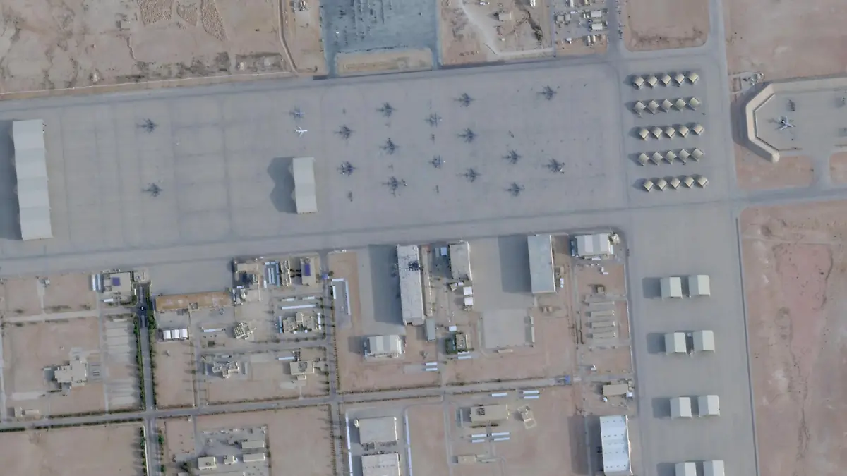
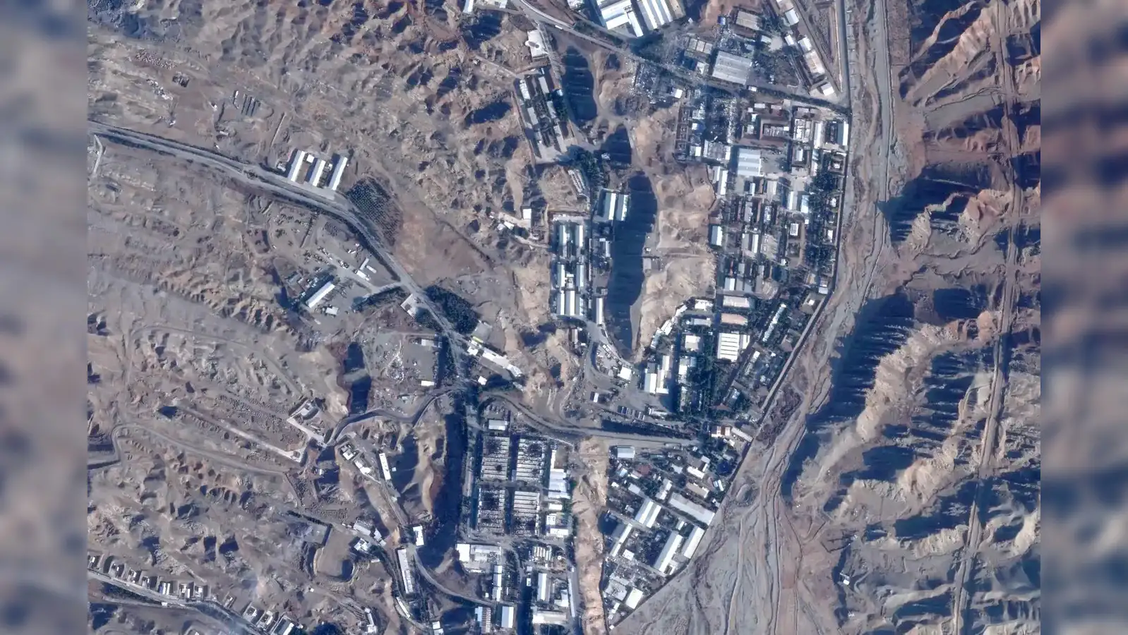
Planet Labs, a U.S. satellite imagery company, announced it will cease publishing high-resolution images of the Middle East conflict area at the request of the Trump administration. This decision affects imagery of Iran and surrounding conflict zones, with a new managed access model expected to last until the conflict concludes.
- 01Planet Labs will stop publishing high-resolution images of the Middle East war area.
- 02The decision follows a request from the U.S. government for national security reasons.
- 03Imagery will now be released on a case-by-case basis, primarily for urgent needs.
- 04The new policy will remain in effect until the end of the conflict.
- 05Other satellite imagery providers, like Vantor, are also implementing restrictions.
Advertisement
In-Article Ad
Planet Labs, a satellite imagery company based in the United States, has decided to halt the publication of high-resolution aerial photographs of the Middle East conflict area. This move comes after a request from President Donald Trump's administration, which cited national security concerns. The company announced that it will implement a managed access model, where imagery will only be released on a case-by-case basis for urgent, mission-critical needs or public interest. This policy is retroactive from March 9, 2026, and is expected to remain in place until the conflict concludes. The area affected includes Iran, allied bases, Gulf states, and existing conflict zones. Planet Labs, founded in 2010 by former NASA scientists, typically provides rapid access to its imagery, which is valuable for various sectors, including media and research. However, the new restrictions align with U.S. laws that allow the government to impose limitations on satellite imagery for reasons related to national security. Other providers, such as Vantor (formerly Maxar), have also announced similar restrictions.
Advertisement
In-Article Ad
The withholding of satellite imagery could hinder media coverage and research related to the conflict, impacting public awareness and understanding.
Advertisement
In-Article Ad
Reader Poll
Do you support the government's decision to restrict satellite imagery for national security?
Connecting to poll...
More about Planet Labs
Read the original article
Visit the source for the complete story.